Daniel Joseph
Recent graduate(May 2021) from the University of Maryland-Baltimore County. B.A. in Environmental Studies with a Minor in Emergency Health Services and a GIScience Certificate. This portfolio includes projects completed using ArcGIS, QGIS, ENVI, and R. View My LinkedIn Profile
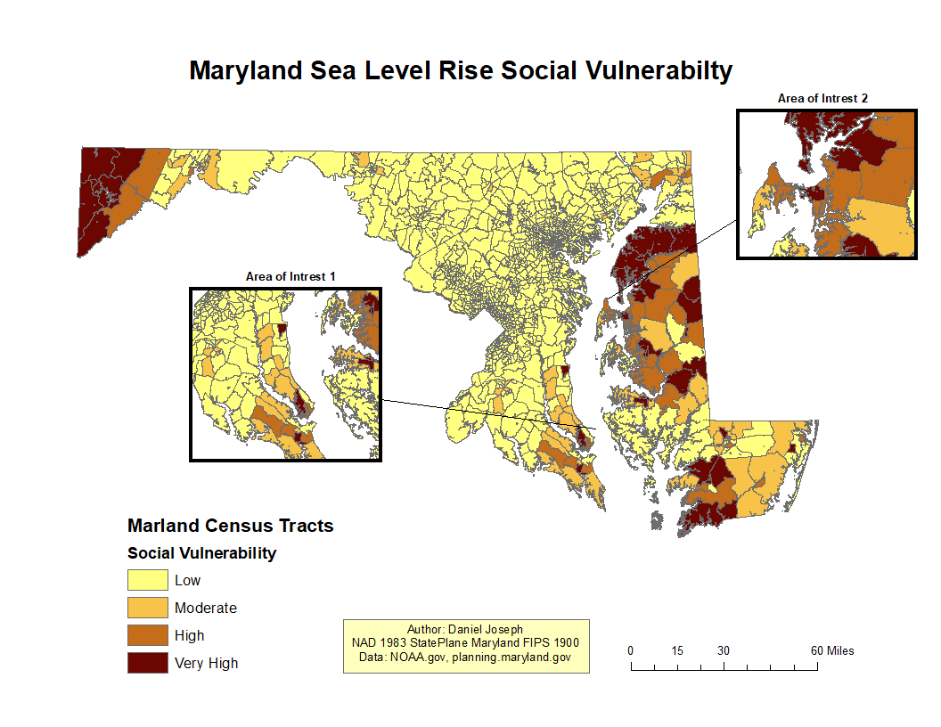
Project 1 (ArcGIS)
Maryland Sea Level Rise Social Vulnerability
Looking at the cooralation between Maryland census tracts social index scores and predicted sea-level rise
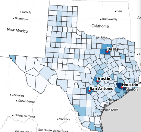
Project 2 (QGIS)
Taking a look at confirmed cases of COVID-19 at the county level in Texas
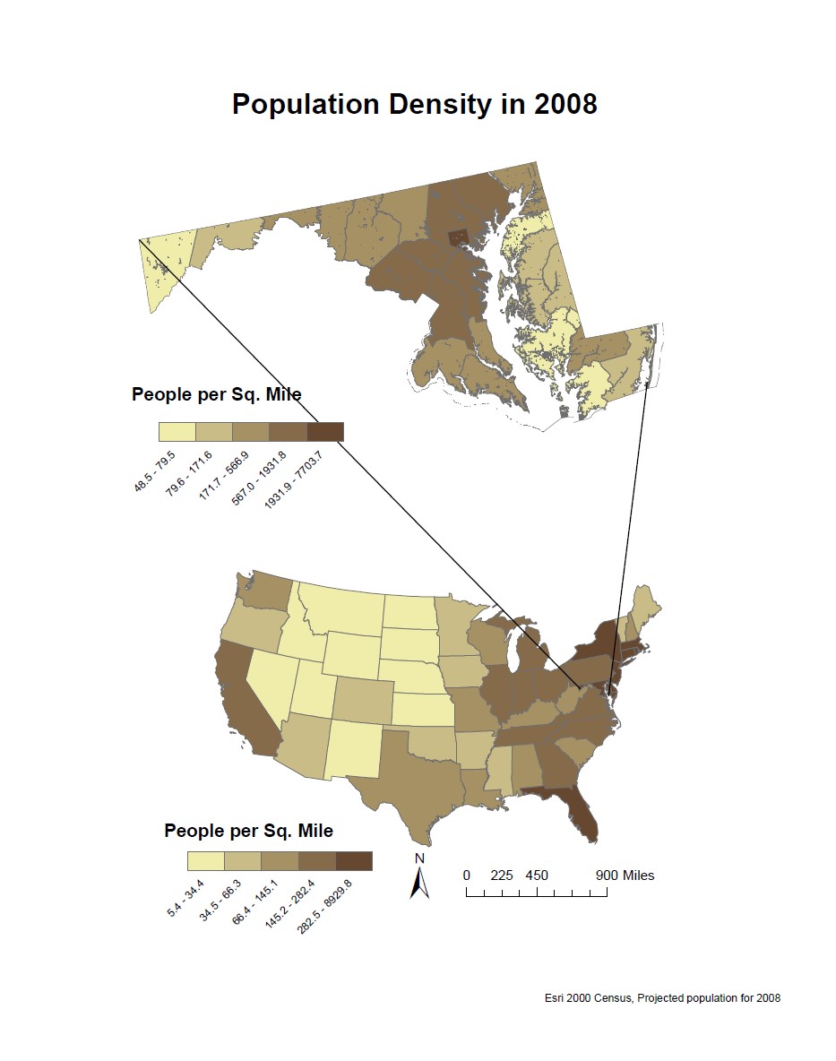
Project 3 (ArcGIS)
Population density of the United States and Maryland in 2008
Project 4 (QGIS and R)
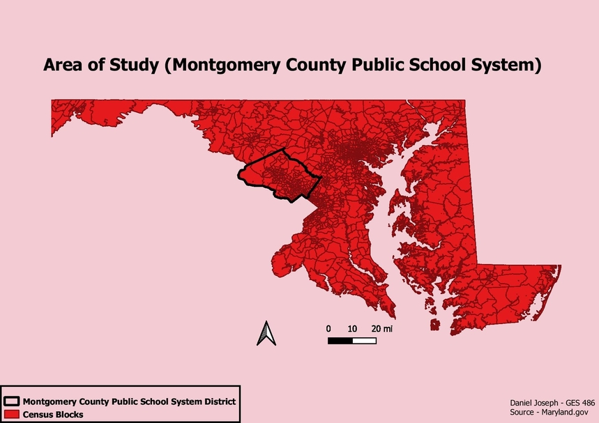
Analysis of High School Graduation Rates
This project focuses on how different socioeconomic factors influence high school graduation rates
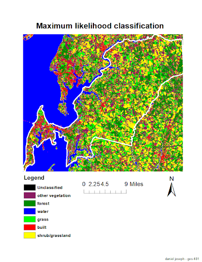
Remote Sensing (ENVI and ArcGIS)
Land Cover Classification and NDVI Post Hurricane Irene
This project looks at the NDVI before and after Hurricane Irene to help create a land cover classification map